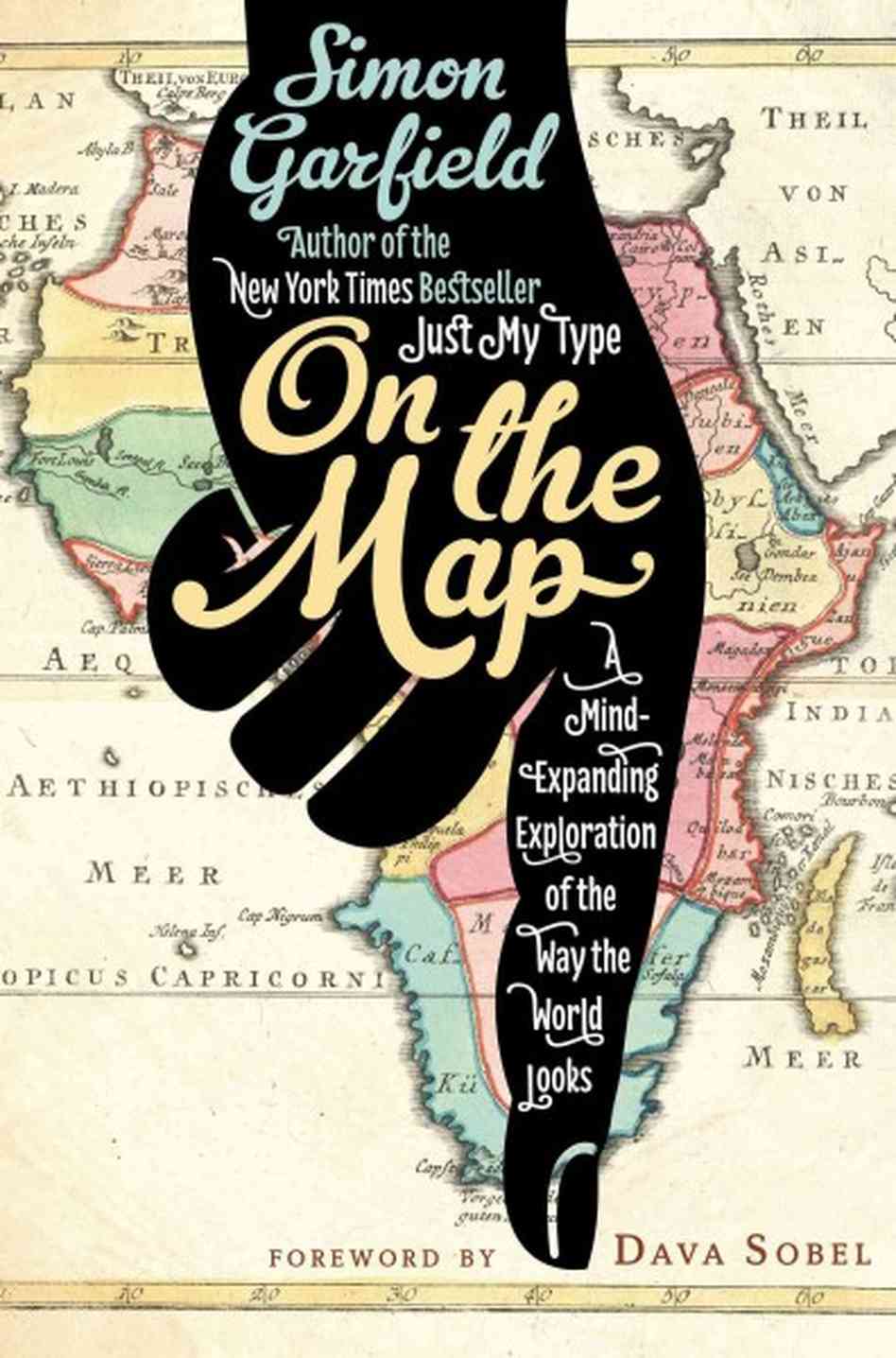
Cartography enthusiasts rejoice: the bestselling author of Just My Type reveals the fascinating relationship between man and map.
The Internet has effected an extraordinary and significant change. Before astronomers faced the gallows for suggesting otherwise, our earth stood firmly at the centre of the cosmos; not so long ago, we placed Jerusalem at the centre of our maps; or if we lived in China, Youzhou. Later, it might be Britain or France, at the heart of their empires. But now we each stand, individually, at the centre of our own map worlds. On our computers, phones and cars, we plot a route not from A to B but from ourselves (‘Allow current location’) to anywhere of our choosing; every distance is measured from where we stand, and as we travel we are ourselves mapped, voluntarily or otherwise.
Earlier this year, a friend of mine noticed an odd thing on his Blackberry. He was walking in the Italian Alps and wanted to check out contours and elevations. When he turned on his phone his bicycle app was open: a handy tool where you put in a London location and it tells you how many bikes are available at each docking station. It was less use in Italy, or so he thought. But, in fact, the app was still working and the map spread out from cycle routes in London to cover the entire world. My friend could plot a route to Ravello, Cape Town or Auckland. Wherever he went, hewas the map, the pivot around which the world diligently spun. And the app was no doubt tracking him, too, so that someone knew which Italian mountain he was on, as well as who was riding the bike he had docked the day before.
How on earth did we get to this point? On The Map is intended as an answer to that question, but it could also be viewed as a journey around an exhibition. It is by necessity an imaginary show, for it contains things that would be impossible to gather in one place: long-destroyed impressions of the world from Ancient Greece, famous treasures from the world’s universities, some jaw-dropping pieces from the British Library and the Library of Congress, rare items from Germany, Venice and California. There will be manuscripts, sea charts, atlases, screen grabs and phone apps. Some exhibits are more important than others, and some are just displayed for amusement. The range will be extensive: poverty and wealth maps, film maps and treasure maps, maps with a penchant for octopuses, maps of Africa, Antarctica and places that never were. Some of the maps will explain the shape of the world, while others will focus on a street or on the path of a plane as it flies to Casablanca.
We’ll need a lot of space for our guides: boastful dealers, finicky surveyors, guesswork philosophers, profligate collectors, unreliable navigators, whistling ramblers, inexperienced globe-makers, nervous curators, hot neuroscientists and lusting conquistadors. Some of them will be familiar names – Claudius Ptolemy, Marco Polo, Winston Churchill, Indiana Jones – and some will be less well known: a Venetian monk, a New York dealer, a London brain mapper, a Dutch entrepreneur, an African tribal leader.
The book is intended as the illustrated catalogue to this show, and it begins in a library on the coast of Egypt. [By: Simon Garfield on Simongarfield.com]
“. . . an erudite romp through cartographical history . . .”
In 1889, J. M. Barrie wrote a half-serious diatribe for an Edinburgh newspaper about, in his opinion, a troubling if mundane item: the folding pocket map.
Pocket maps weren’t a new item, but Barrie apparently suffered from the common affliction, still prevalent in our own day, of being unable to refold one properly. Barrie complained that once a pocket map entered a household, not even the whole family working together could fold it back up once it was opened.
“What makes you buy it?” Barrie wondered. “In your heart you know you are only taking home a pocket of unhappiness.” But as the British journalist Simon Garfield points out in On the Map, his erudite romp through cartographical history, Barrie would go on to write one of the simplest and most beautiful of map directions: “Second to the right, then straight on till morning.”
Mr. Garfield, like fellow observers of the deceivingly trivial such as Malcolm Gladwell and Susan Orlean, has a knack for endowing the quotidian with cultural, sociological, philosophical and historical weight.
In his previous bestseller Just My Type, he led us through the arcane world of type design, from the social significance of the ongoing wars over Comic Sans to the ubiquity of Helvetica, which he managed to elevate to almost Orwellian proportions.
In his new book, Mr. Garfield uses cartography as a springboard to similar explorations of how we have viewed not only the world around us, but ourselves. “Maps hold a clue to what makes us human,” Mr Garfield writes. “They reflect our best and worst attributes – discovery and curiosity, conflict and destruction—and they chart our transitions of power.”
For ancient Greeks, maps were an integral component of their urge to analyze and measure the world around them and to fit it into their humanist philosophies. In later centuries, maps were a way to correlate religious faith with geographical fact, the most famous example being the 13th century Mappa Mundi at Hereford Cathedral, which Mr. Garfield views as a “morality painting,” with Jerusalem at the center of the world and Heaven and Purgatory at its opposite ends. It served as a spiritual guide for a mostly illiterate population, a mashup of world geography as known at the time and the religious terrain of medieval Christianity.
Later still, maps were the cause of border wars, the justification for the depredations of colonialism and even, in the case of a devastating cholera epidemic in Victorian London, the mechanism for discovering the cause of a disease.
Mr. Garfield has a gift for mixing such freighted subject matter with lighter material, thanks to his impish sense of humor and his airy, flowing prose. He reveals, for example, a real Treasure Island discovered years before Robert Louis Stevenson’s imaginary one; the pop cultural side of maps as he embarks on a tacky Hollywood tour of movie star homes; and an impassable West African mountain range alluringly named “The Mountains Of Kong” that survived on maps of Africa into the early 20th century, even after a French army officer went looking for them and found they weren’t there.
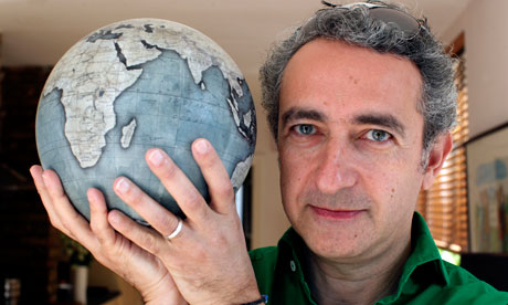
There are digressions into mapping the human brain, the significance of GPS navigation for the survival of old fashioned paper maps, and the struggles of a young British maker of bespoke globes. (“Making anything round is just a nightmare,” he observes.)
Mr. Garfield comes full circle near the end of the book, with the observation that like the geocentric universe depicted on ancient maps, we are now all at the center of our own digital maps thanks to the location services of our cellphones and tablets.
But the purpose of maps, whether digital or paper or pasted on a globe, remains the same.
“When we gaze at a map,” Mr. Garfield writes, “we still find nothing so much as history and ourselves.” [A Review from Yyjournalofbooks.com]
Innumerable modes of seeing the world unfold in this exuberant history of maps. Garfield (Just My Type) loosely follows the development of cartography, taking in the precociously scientific geography of the ancient Greeks; medieval England’s Hereford Mappa Mundi, drenched in Christian allegory and teeming with mythical beasts; the Age of Exploration’s heroic maps of newly discovered, sketchily drawn, and wrongly designated landmasses (America got its name from a cartographer’s erroneous belief that Amerigo Vespucci discovered it); the 19th-century map that established cholera as a water-borne disease; modern GPS systems, and video game fantasy maps. Along the way he pursues diverting cartographical anecdotes and oddities, including the centuries-long consensus that California was an island, the lingering conceit that women can’t read maps, and the appearance and disappearance of canals on maps of Mars. Garfield’s coverage of this terrain, lavishly illustrated with reproductions of famous maps, is broad but paper-thin—more a meandering guided tour than a systematic survey. Still, his droll humor and infectious curiosity will keep readers engrossed as he uncovers surprising ways in which maps chart our imaginations as much as they do the ground underfoot. [From: Publishersweekly.com]
A vivid foray into the romance of maps. This is a roughly chronological survey of choice moments in cartography, with Garfield (Just My Type: A Book About Fonts, 2011, etc.) keeping his focus trained on maps that present not just the lay of the land, but that transport and move us–maps that have something to say about who we are at some particular historical point in time. Although he starts with Eratosthenes, Strabo and Ptolemy, the author digs into the mysterious allure of maps after the strange interruption in mapmaking that followed Ptolemy for more than 1,000 years. Longer chapters provide lively histories of great maps, cartographic phantoms like the Mountains of Kong in Africa or the detective work of Dr. Snow’s London cholera map. Garfield is equally at ease with treasure maps, where the loot is guarded by dangerous reefs, angry birds and an army of land crabs, or when ruminating on the great blank spots in 19th-century maps of Africa, suggestive of empty territory for the imperial taking. The author punctuates these chapters with colorful cartographic squibs on, for example, Churchill’s map room or how Kit Williams’ jeweled hare was found (not by a close reading of Williams’ book Masquerade). Always present is a concern for how maps touch us: “We may detect the emotional state of the amateur cartographer through the graphite and the nib of hand-drawn markings, and because we know we are witnessing history as it happens.” Garfield also looks at maps in the movie Casablanca, which brought us to northwest Africa, how the game Monopoly made us familiar with Atlantic City and how GPS has such a hold on our everyday lives. A fine, fun presentation of the brand of cartography that continues to whet our imaginations. [From: Kirkusreviews.com]
If you like this story, CLICK HERE to join the tribe of success-minded people just like you. You will love our weekly quick summaries of top stories, talks, books, movies, music and more with handy downloadable guides, cheat sheets, cliffs notes and quote books.
